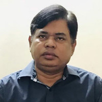
Dr. Muhammod Nazrul Islam Professor, Institute of Remote Sensing and GIS
Professor Dr. M. Nazrul Islam is a distinguished scholar and a senior professor with a rich academic and professional background in physical geography, specializing in fluvial-geomorphological and environmental sciences. He currently serves as the Director of the Institute of Remote Sensing and GIS at Jahangirnagar University and carries nearly 35 years of experience in teaching, research, and consultancy. Dr. Islam completed his B.Sc. (Hons) and M.Sc. in Geography from Jahangirnagar University with first-class first positions on both occasions, and earned his Ph.D. in Physical Geography from the University of Hull, England, in 2000. His academic journey has included prestigious research fellowships with the British Royal Society and the British Commonwealth.
Dr. Islam’s research focuses on critical issues such as climate change adaptation, disaster resilience, food security, environmental impact assessment, and river channel dynamics. He has published over 70 papers in internationally and nationally recognized journals and is renowned for his work on geomorphology, hydrology, floodplain management, and environmental hazards. His extensive academic experience includes teaching roles at several leading universities in home and abroad, and he has led numerous national and international collaborative projects, often in a directorial or principal investigator role.
Dr. Islam’s expertise in GIS and Remote Sensing, combined with his commitment to academic and research excellence, is a pioneer in his leadership at the Institute. He has a professional background in disaster management and environmental planning and brings a forward-thinking approach to the Institute’s programs, fostering an environment of learning, discovery, and collaboration.
Dr. Muhammod Nazrul Islam

