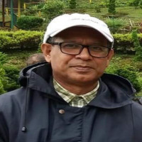
PROFILE
SHORT BIOGRAPHY
N/A
RESEARCH INTEREST
Physical Geography, Geomorphology, Environmental Remote sensing.
JOURNAL PAPER
1) Jahan N. and Alam M.S., Environmental education at primary level (class III-V)curriculum in Bangladesh: a case study on the reflection of environmental education on children’s knowledge and environmental attitude, Oriental Geographer, vol.58(2), pp.1-13, 2017.2) Salam M. A. and Alam M. S., Landscape Transformation in Turag River basin between 1980 and 2010, J. Environ. Sci. & Natural Resources, 7(2), pp.115-125,
3) Islam R. and Alam M.S, Floodplain transformation and associated environmental consequences: a case study on the the Lower Bangsi river, The Jahangirnagar Review, Part II: Social Sciences, xxxiv(2010),, pp.23-24, 2014.
4) Salam M.A. and Alam M.S, Identification and delineation of Turag river basin boundary using remote sensing techniques, J. Environmental Science and Natural Resources, 7(1), 2014.
5) Ahamad S.S. and Alam M.S, Rainfall in Chittagong city and aspects of drainage congestion: spatio-temporal perspective, Jahangirnagar University J. of Science, 34(1), pp.31-45, 2011.
6) Saifuzzaman M., Shamsuddin D. and Alam M.S., Effectivenessof high resolution satellite imagery for identification of land, and water features in an archeological site in Bangladesh, The Jahangirnagar Review, XXII, pp.275-288, 2010-11.
7) Saifuzzaman M. and Alam M.S., Changes in physical environment of the south-western coastal Bangladesh: a river basin approach, Khulna University Studies, Special issue, 2010.
8) Segufta H.,Saifuzzaman M. and Alam M.S., Urban environmental change: a case study on eastern Dhaka city wetlands transformation from 1963 to 2009, BIIS Journal, 31(2), pp.167-189, 2010.
9) Alam M.S., Rashid M.S. and Shamsuddin S.D., Boundary and border issues and determining the sea boundary of Bangladesh on the Bay of Bengal based on the UNCLOS, J. of the Bangladesh National Geographical Association, 36(1&2), pp.15-30, 2008.
10) Shamsuddin S.D., Rashid M.S. and Alam M.S, Methodological Approaches to the study of Mouza names in Bangladesh, The Jahangirnagar Review Part II: Social Science, XXX, pp.189-217, 2006.
53) Mafizuddin M. and Alam M.S., Morphometry of Madhupur rivers, Bangladesh National Geographical Association, Special publication, Dhaka., 1984.
54) Mafizuddin M., Alam M.S. and Momtaz D., Physical parameters of the Ganges and the Jamuna river: a comparative study., Oriental Geographer, vol. 28(1&2)., 1984.
55) Mafizuddin M. and Alam M.S., Seasonal variation of water quality of the Brahmaputra river at Bahadurabad: preliminary results, Journal of the Bangladesh National Geographical Association, Vol. 9(1&2): 13-23., 1984.
56) Mafizuddin M. and Alam M.S., Waters table aggregate as a measure of spatial variation of erodibility: a case study on the Madhupur tract, Oriental Geographer, vol. 27(1&2), 1983.
57) Mafizuddin M. and Alam M.S., A study on micro-climatic variation in the Madhupur tract, Jahangirnagar Review, Part ii,, vol.6., 1982.
58) Alam M.S., Environmental Problems in the Madhupur National Park., Environment and Region,, vol 1(1), 1982.
BOOK CHAPTER
1) Imtiaz N. and M.S. Alam, Health-care wastes of Dhaka city: a socio – economic environmental assessment, In: Ahmed M.F. (eds.): Bangladesh Environment 2002, BAPA, pp.751 - 769, 2002.2) Alam M.S., Introduction to Geography and Environment, B.A./B.S.S programme, Bangladesh Open University, Course code BGE 2301, Gazipur, pp.247, 2003.
3) Alam M.S. (in press), Economic Geography, Two credits text written for Higher Secondary Certificate Programme, Bangladesh Open University.,
4) Alam M.S., Shamsuddin S.D. Rashid M.S. and Hossain D., Sylhet region: its evolving geographical environment, In: Ahmed S.(ed.): Sylhet: History and Heritage, Bangladesh Itihas Samity, pp.73-82,
THESIS SUPERVISION
Forest inventory of the Sundarbans using remote sensing, 1994.Development of Geography Curriculum from primary to graduate levels in Bangladesh: an analytical discourse on historical trend, 2008.
Teaching
| Course Code | Course Title | Semester/Year |
|---|---|---|
| 505 | Fundamentals of Remote Sensing | MSGED |
| GeoE. 502 | Research Methodology | MSc |
| GeoE. 211 (Lab) | Practical Geography: Fieldwork Techniques and Projects -II | 2nd Year (BSc Hons) |
| GeoE. 202 | Geomorphology -I | 2nd Year (BSc Hons) |
| GeoE. 110 (Lab) | Practical Geography: Topographic Surveying Techniques | 1st Year (BSc Hons) |
| GeoE. 101 | Introduction to Physical Geography and Environment | 1st Year (BSc Hons) |
Academic Info
Period: 1995-1996
Post Doctoral Fellow
Period: 1984 - 1987
Ph.D. in Remote Sensing
Period: 1979
M.Sc. in Geography
Period: 1978
B.Sc. (Hons)
Experience
Period: January 2004
Reflection of Institutional Preparedness on Community on Flood Disaster, financed by Network for Information, Response and Preparedness Activities on Disaster (NIRAPAD)
Position: Environmental Consultant
Period: 2005
Assign to prepare an Initial Environmental Assessment of the Chittagong City and the Surrounding Area under the project of Multi-sector Infrastructure Development in Chittagong.
Position: Co-researcher
Period: 2008-2009
National Adaptation Interventions to address climate change-induced flood hazard: A Strategic Environmental and Social Impact Assessment, Financial support given by Action Aid Bangladesh.
Activity
Spacial Institution Visited/Attended and Courses Taken
|
· 20th International Short course on Environmental Management for Developing Countries- Sustainable Management, 7-28 September, 2000, Dresden University of Technology, Federal Republic of Germany; Sponsored by UNESCO/UNEP/BMU. · Visited 6 major Indian remote sensing institutes located in Bangalore, Ahmedabad, Hyderabad, Dheradun, Delhi, and Calcutta from 6-30 October, 1992 sponsored by UNDP. · Workshop on application of remote sensing to flood plain mapping and flood monitoring, sponsored by ESCAP and SPARRSO, Dhaka, Dec. 11-15, 1989; · Workshop on river flow modelling and forecasting ; sponsored by Bangladesh Univ. of Engineering and Technology and BWDB, Dec. 4 - 7, 1989; · Workshop on remote sensing techniques with applications to agriculture, water and weather resources; International Centre for Theoretical Physics (ICTP), Trieste, Italy, 27 Feb.- 21 March, 1989; · Workshop on satellite oceanography, sponsored by NASA,USA and SPARRSO, Bangladesh, 12-29 June, 1988; · Workshop on technology assessment and technology diffusion, Bangladesh Univ. of Engineering and Technology, Dhaka, April,1988; · Fortran Programming, MTS and the GIMMs graphics, Univ. of Durham computer centre, 1985-’86; · Post graduate training course, Department of Geography, University of Durham, 1984-’85; · Research design for geomorphology, Cumbria Lodge, UK, sponsored by the NERC and BGRG, UK, 1984 |
|
|
Contact
Dr. Mohd. Shamsul Alam
Professor
Department of Geography & Environment
Jahangirnagar University, Savar, Dhaka-1342, Bangladesh.
Cell Phone: +8801816704748
Email: m.s.alam.ju@juniv.edu
, m.s.alam.ju@gmail.com


